Daijiworld Media Network - Panaji
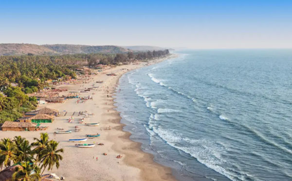
Panaji, Mar 18: A new shoreline assessment by the National Centre for Sustainable Coastal Management (NCSCM) in Chennai has revealed a significant decline in the stability of Goa’s coastline, with only about 14% of its 193.9-km shoreline now classified as stable.
According to the report, roughly 27 km of the state’s coastline currently meets the stability criteria, while around 2.7% of beach area has already been lost to erosion.
The findings mark a sharp decline from an earlier study conducted by the ISRO Space Applications Centre in Ahmedabad, which analysed shoreline changes between 2004–06 and 2014–16. That study had identified 116.7 km of Goa’s coast as stable — among the highest levels of stability recorded among Indian states and Union Territories.
Under NCSCM’s classification, a coastline is considered stable when erosion does not exceed 0.5 metres per year and accretion — the natural build-up of sand or sediment — is also not greater than 0.5 metres annually. In certain stretches of Pernem, however, erosion has been recorded at around 0.7 metres per year.
The report attributes the changing shoreline to a combination of natural processes and human activities. In particular, disturbance of coastal sand dunes due to human intervention has made several stretches more vulnerable to erosion.
Presenting the report’s findings in the state assembly, Chief Minister Pramod Sawant, who also holds the environment portfolio, said about half of Goa’s coastline is sandy while the remaining half consists of rocky terrain.
He noted that the proportion of coastline experiencing erosion has increased from 22% to 27%, a rise of five percentage points. By comparison, the extent of coastal accretion grew only marginally, from 7% to 9%.
Among individual beaches, Cavelossim Beach recorded the highest number of erosion points, with eight affected locations, followed by seven along Baina Beach.
In Mormugao taluka, erosion has been identified across multiple stretches, including seven along Baina, two each at Japanese Garden, Velsao Beach and Arossim Beach, and one at Bogmalo Beach.
Experts note that shoreline patterns are highly dynamic and can vary seasonally, with some beaches experiencing temporary changes during different periods of the year.
Earlier, the National Green Tribunal recommended replacing hard coastal defence structures such as seawalls and groynes with softer solutions like beach nourishment to combat erosion.
Following this guidance, the Goa government has partnered with Deltares, a research institute linked to the Netherlands government, to restore eroded beaches. Sawant said beach replenishment work is currently underway in collaboration with the institute.
Deltares has identified eight major erosion hotspots that could be considered for pilot restoration projects: Palolem Beach, the stretch between Majorda Beach and Cavelossim Beach, Velsao Beach, Candolim Beach, Anjuna Beach, Morjim Beach, Mandrem Beach and Querim Beach.
Initial assessments by the institute suggest that erosion along Goa’s coast could be effectively managed through nature-based solutions.
Data presented in the assembly also highlighted several erosion-affected stretches in Pernem taluka — including five each along Mandrem and Ashvem, four in Morjim, three in Querim, two in Arambol and one in Paliem.
Many of the beaches facing erosion are also important for tourism, fishing activities, coastal plantations and ecological conservation — including the turtle nesting site at Morjim Beach.
In Bardez taluka, erosion has been observed at five stretches along Candolim, three at Calangute Beach, two each at Anjuna and Vagator, and one at Ozran Beach.
Meanwhile, in Tiswadi taluka, erosion has been detected at Miramar Beach, Caranzalem Beach, Dona Paula, Vainguinim Beach, Odxel Beach and Bambolim Beach.
Other beaches witnessing erosion in Salcete include Utorda Beach, Gonsua Beach, Betalbatim Beach, Colva Beach, Sernabatim Beach, Benaulim Beach and Varca Beach.
Sawant added that coastal erosion across the state is being closely monitored through satellite imagery to track ongoing changes and guide future mitigation efforts.