Daijiworld Media Network - Sriharikota
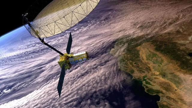
Sriharikota, Jul 19: NASA and Indian Space Research Organisation (ISRO) are set to launch NISAR, a cutting-edge Earth-observing satellite designed to provide high-resolution 3D views of Earth’s land and ice surfaces. The satellite, a first-of-its-kind joint mission between the two space agencies, is scheduled for lift-off no earlier than late July from ISRO’s Satish Dhawan Space Centre in Sriharikota.
NISAR (NASA-ISRO Synthetic Aperture Radar) will carry a dual-band radar system, combining NASA’s L-band radar and ISRO’s S-band radar. This unique pairing enables the satellite to detect minute ground movements—down to the centimetre—through clouds, vegetation, and even soil.

The mission will systematically scan nearly all of Earth’s land and ice twice every 12 days, capturing dynamic changes such as ground deformation from earthquakes, volcanic activity, and landslides. It will also be instrumental in disaster response, offering precise flood mapping and storm damage assessment regardless of weather conditions.
Managed by NASA’s Jet Propulsion Laboratory, NISAR will offer scientists around the world a powerful new tool to study climate change, monitor glaciers, track deforestation, and safeguard communities from natural hazards.
NASA will host a live-streamed press briefing at 12 pm EDT on Monday, July 21, to preview the mission and its groundbreaking scientific goals.